
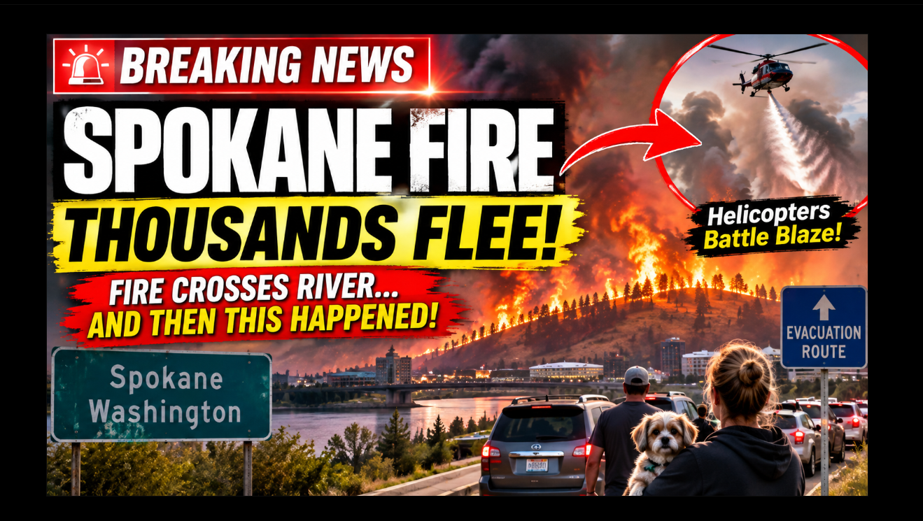
Spokane fires force thousands to evacuate as the Old Trails Fire spreads rapidly across Spokane, Washington. See the latest Spokane fire map, evacuation zones, and official updates.
Spokane Fires Trigger Major Emergency Across Eastern Washington
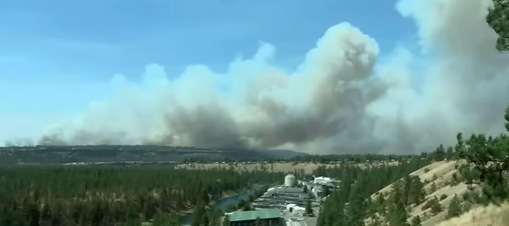
The smoke was visible for miles before many residents in Spokane, Washington, realized how quickly the danger was approaching.
What began as a wildfire on the western edge of Spokane County rapidly transformed into one of the most serious fire emergencies eastern Washington has faced this summer. Driven by extreme heat, dry vegetation, and powerful winds, the Old Trails Fire spread aggressively across rugged terrain, crossed the Spokane River, and forced thousands of people to flee their homes as evacuation zones expanded through the evening.
Authorities say the fire remained 0% contained during the latest official update, while emergency crews worked through the night to protect homes, businesses, and critical infrastructure. Washington Governor Bob Ferguson declared a state of emergency as the blaze intensified and additional firefighting resources were requested from across the state. AP News KREM
What Happened in Spokane, Washington?
The wildfire began near the Old Trails area west of Spokane and expanded with alarming speed as wind gusts pushed flames through grass, brush, and timber.
Within hours, the fire jumped natural barriers that firefighters had hoped would slow its advance. The most dramatic development came when officials confirmed that flames had crossed the Spokane River, creating new threats to neighborhoods on the eastern side of the burn area. AP News
Residents described ash falling from the sky, thick smoke reducing visibility, and emergency alerts arriving on their phones as conditions changed minute by minute.
One Spokane resident told local reporters:
“We could see the smoke getting darker every hour. Then the evacuation alert came, and within minutes neighbors were loading cars and leaving.”
That sense of urgency spread quickly across multiple communities as officials expanded evacuation orders.
Spokane Fire Map: Where the Blaze Is Burning
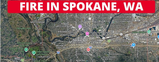
The latest Spokane fire map shows the Old Trails Fire affecting areas west and southwest of the city, with growth pushing toward additional residential zones.
Officials have urged residents to rely on official Spokane County emergency mapping tools rather than screenshots circulating on social media.
Key areas affected include:
- Old Trails
- West Plains
- Parts of southwest Spokane County
- Areas near the Spokane River corridor
Fire managers say the map is changing frequently as aircraft, drones, and ground crews provide updated perimeter information. Residents are being asked to check official evacuation and fire mapping websites several times a day.
Spokane Evacuation Map: Thousands Ordered to Leave
The Spokane evacuation map has expanded repeatedly since the fire began.
Emergency officials issued a combination of:
- Level 3 (“Go Now”) evacuations
- Level 2 (“Be Set”) alerts
- Level 1 (“Be Ready”) notices
Thousands of residents have been affected by the evacuation orders, with shelters opened for displaced families, pets, and livestock.
Authorities stressed that evacuation levels can change rapidly and that residents should leave immediately when Level 3 orders are issued.
Traffic congestion was reported on several roads as people attempted to leave threatened areas simultaneously.
Firefighters Face Extreme Conditions
The challenge confronting firefighters is not simply the size of the blaze—it is the combination of heat, wind, and terrain.
Officials reported temperatures well above seasonal averages, critically dry fuels, and shifting winds that repeatedly changed the fire’s direction.
More than 400 firefighters were assigned to the incident, supported by:
- Helicopters
- Air tankers
- Bulldozers
- Engine crews
- Hand crews
Despite those resources, fire behavior remained aggressive through much of the day.
A spokesperson for the Washington Department of Natural Resources said crews were prioritizing life safety and structure protection while looking for opportunities to establish containment lines.
Structures Destroyed as Fire Advances
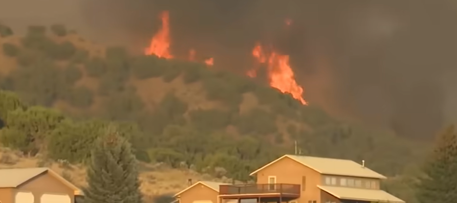
Authorities have confirmed that multiple structures have been destroyed, though a full damage assessment is still underway.
Officials have not yet released the exact number of homes lost, but emergency managers acknowledged that residential properties were among the structures affected.
Teams will begin detailed inspections once conditions become safe enough for investigators and assessors to enter the burn area.
For many residents, the uncertainty has become one of the hardest parts of the disaster.
Why These Spokane Fires Are Spreading So Fast
Wildfire experts say the current conditions in eastern Washington are creating an environment where fires can spread with exceptional speed.
Several factors are contributing:
Extreme Heat
Hot temperatures dry out grasses and vegetation, making ignition easier and fire spread faster.
Strong Winds
Wind carries embers ahead of the main fire, allowing new spot fires to start far from the original perimeter.
Dry Fuels
Months of below-normal moisture have left vegetation highly combustible.
River Crossing
When a fire crosses a major geographic feature such as the Spokane River, it can create entirely new fronts that are difficult to predict.
These factors combined to make the Spokane fire especially challenging for crews.
Smoke Impacts Across Spokane Washington
Even residents far from evacuation zones have felt the effects of the wildfire.
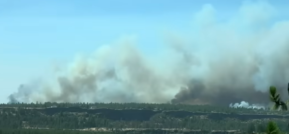
Air quality deteriorated across much of Spokane, Washington, with smoke visible over the city and surrounding communities.
Health officials advised people to:
- Stay indoors when possible
- Use air filtration if available
- Avoid strenuous outdoor activity
- Wear a properly fitted N95 mask if exposure is unavoidable
Hospitals and clinics also reported increased concerns related to smoke exposure, particularly among children, older adults, and people with respiratory conditions.
State of Emergency Declared
Governor Bob Ferguson’s emergency declaration allows the state to mobilize additional resources more quickly and coordinate support for affected communities.
The declaration also helps streamline assistance for firefighting operations, emergency shelters, transportation, and recovery planning.
Officials emphasized that the situation remains fluid and that weather conditions over the next 24 to 48 hours will be critical.
Key Facts So Far
- 📍 Location: Spokane County, Washington
- 🔥 Fire: Old Trails Fire
- 🌉 Major development: Fire crossed the Spokane River
- 🏠 Evacuations: Thousands affected
- 🚒Containment: 0% at latest update
- 🏛️ Emergency: State of emergency declared
- 🌫️Air quality: Smoke impacting Spokane and nearby communities
- 🧯 Resources: 400+ firefighters, aircraft, and heavy equipment assigned
The story is still developing, and officials say the next several hours could determine whether crews can slow the fire’s advance before weather conditions become even more dangerous.
Spokane Fires: Investigation, Weather Challenges, and the Road Ahead
As firefighters continue battling the rapidly growing Spokane fires, emergency officials warn that the situation remains highly unpredictable. While aggressive air and ground operations have slowed parts of the fire’s advance, authorities say shifting winds and extremely dry vegetation continue to create dangerous conditions across Spokane, Washington.
Emergency management officials have urged residents not to return to evacuated neighborhoods until formal clearance is issued, emphasizing that hazards such as falling trees, damaged power lines, and smoldering hotspots remain throughout the affected areas.
Timeline of the Spokane Fire
Understanding how quickly the fire developed highlights why thousands of residents had so little time to prepare.
Fire Ignites
The Old Trails Fire was first reported west of Spokane County during a period of extreme heat and gusty winds.
Rapid Fire Growth
Within hours, the wildfire expanded rapidly through dry grasslands and wooded terrain, overwhelming initial containment efforts.
Fire Crosses the Spokane River
One of the most significant developments occurred when flames crossed the Spokane River, creating new threats to nearby neighborhoods and forcing firefighters to reposition resources.
Evacuations Expand
Authorities issued multiple Level 3 (“Go Now”) evacuation orders, followed by additional Level 2 and Level 1 alerts as the fire continued spreading.
State of Emergency Declared
Governor Bob Ferguson declared a state of emergency, allowing additional personnel, aircraft, and emergency resources to support local firefighting operations.
Spokane Fire Map: Why It Changes Constantly
Many residents have searched for the latest Spokane fire map to determine whether their homes are at risk.
Fire officials stress that wildfire perimeters can change significantly within hours due to:
- Wind direction
- Terrain
- Fuel conditions
- Spot fires started by airborne embers
For that reason, residents should rely on official wildfire mapping services and Spokane County emergency notifications rather than screenshots shared on social media.
Spokane Evacuation Map: Understanding the Alert Levels
The Spokane evacuation map uses three warning levels designed to help residents act before conditions become life-threatening.
Level 1 – Be Ready
Residents should monitor updates, prepare emergency kits, and be ready to leave if conditions worsen.
Level 2 – Be Set
People should gather essential belongings, prepare vehicles, and be ready to evacuate at a moment’s notice.
Level 3 – Go Now
Residents must leave immediately because remaining in the area may place lives at serious risk.
Emergency managers continue updating evacuation zones as firefighters assess changing fire behavior.
Weather Remains the Biggest Challenge
Although hundreds of firefighters remain on the fire lines, weather continues to be the greatest obstacle.
Forecasts indicate:
- Hot temperatures
- Low humidity
- Dry vegetation
- Occasional wind gusts
These conditions increase the likelihood of rapid fire spread and make containment efforts significantly more difficult.
Even if flames appear to slow temporarily, officials warn that changing winds could quickly reignite active fire fronts.
Communities Rally Together
Despite the devastation, the response from local communities has been remarkable.
Volunteer organizations, churches, schools, and businesses have opened temporary shelters and donation centers for displaced residents.
Animal rescue groups are assisting families forced to evacuate with pets and livestock, while local charities are collecting food, clothing, and emergency supplies.
Officials praised the cooperation between residents, firefighters, law enforcement officers, emergency medical teams, and volunteers during the ongoing emergency.
What Residents Should Do Now
Emergency officials continue advising residents to:
- Monitor official evacuation alerts.
- Avoid closed roads and restricted areas.
- Prepare emergency supply kits.
- Follow instructions from local authorities.
- Stay informed through verified government sources.
Returning to evacuated areas before authorities declare them safe could place both residents and emergency responders at risk.
Google Snippet
What are the Spokane fires?
The Spokane fires refer to the rapidly spreading Old Trails Fire burning near Spokane, Washington. Fueled by extreme heat, dry vegetation, and strong winds, the wildfire crossed the Spokane River, forced thousands of evacuations, destroyed structures, and prompted a statewide emergency declaration as firefighters continue working toward containment.
Google FAQs
What caused the Spokane fires?
The official cause of the Old Trails Fire has not yet been determined. Investigators are examining the origin while firefighters continue suppression efforts.
Where is the Spokane fire burning?
The wildfire is burning in Spokane County, primarily affecting areas west and southwest of the city and the Spokane River corridor.
What is the Spokane fire map?
The Spokane fire map is an official resource showing the current wildfire perimeter, evacuation zones, and affected communities.
What is the Spokane evacuation map?
The Spokane evacuation map displays Level 1, Level 2, and Level 3 evacuation areas to help residents know when to prepare or leave immediately.
Has the Spokane River stopped the fire?
No. Officials confirmed the wildfire crossed the Spokane River, creating additional fire fronts.
How many firefighters are responding?
More than 400 firefighters, supported by aircraft and heavy equipment, have been assigned to the incident.
Are homes destroyed?
Yes. Authorities have confirmed that multiple structures were destroyed, although damage assessments are still underway.
Is the fire contained?
No. According to the latest official updates, the fire remains largely uncontained, and suppression efforts continue.
Is Spokane safe to visit?
Residents and visitors should avoid evacuation zones and follow guidance from local authorities. Conditions may change rapidly depending on weather and fire activity.
Where can I get official updates?
Official updates are available from the Washington Department of Natural Resources, Spokane County Emergency Management, and the National Interagency Fire Center.
Final Thoughts
The Spokane fires have become one of the most significant wildfire emergencies in Washington this year, underscoring how quickly extreme weather can transform a routine summer day into a large-scale disaster. With thousands of residents displaced, structures destroyed, and firefighters working around the clock, the coming days will be critical in determining whether changing weather conditions allow crews to gain control of the blaze.
For now, officials continue to urge residents to monitor the Spokane fire map and Spokane evacuation map, follow evacuation orders without delay, and rely only on verified information from emergency agencies. As the investigation into the fire’s cause continues and containment efforts progress, the focus remains on protecting lives, safeguarding property, and supporting the communities affected by this rapidly evolving emergency.